Anthropo-
cene
 Landform, Michael Sullivan Smith, 2008
The animation above takes hundreds of thousands of lines positioned at locations to articulate topology at what's thought of as the surface of a larger geographic area and illustrates them being transformed into the area that is focused on to give the Great Knot its presence within this site specific spirit. It seeks to express the geomorphic isolation in man's use of the current interglaciation appearance of a stratotype record of the Holocene to invent the Anthropocene and return it, in a structured way, to Earth's overall history where intellectual intentions shape our human presence into something of a scale of significance by forming the geological past exposed throughout the hundreds of quarry settings of the greater site's geography of the eastern Catskills foothills into a knot's form as a recognizable symbol of a work of man. |

|
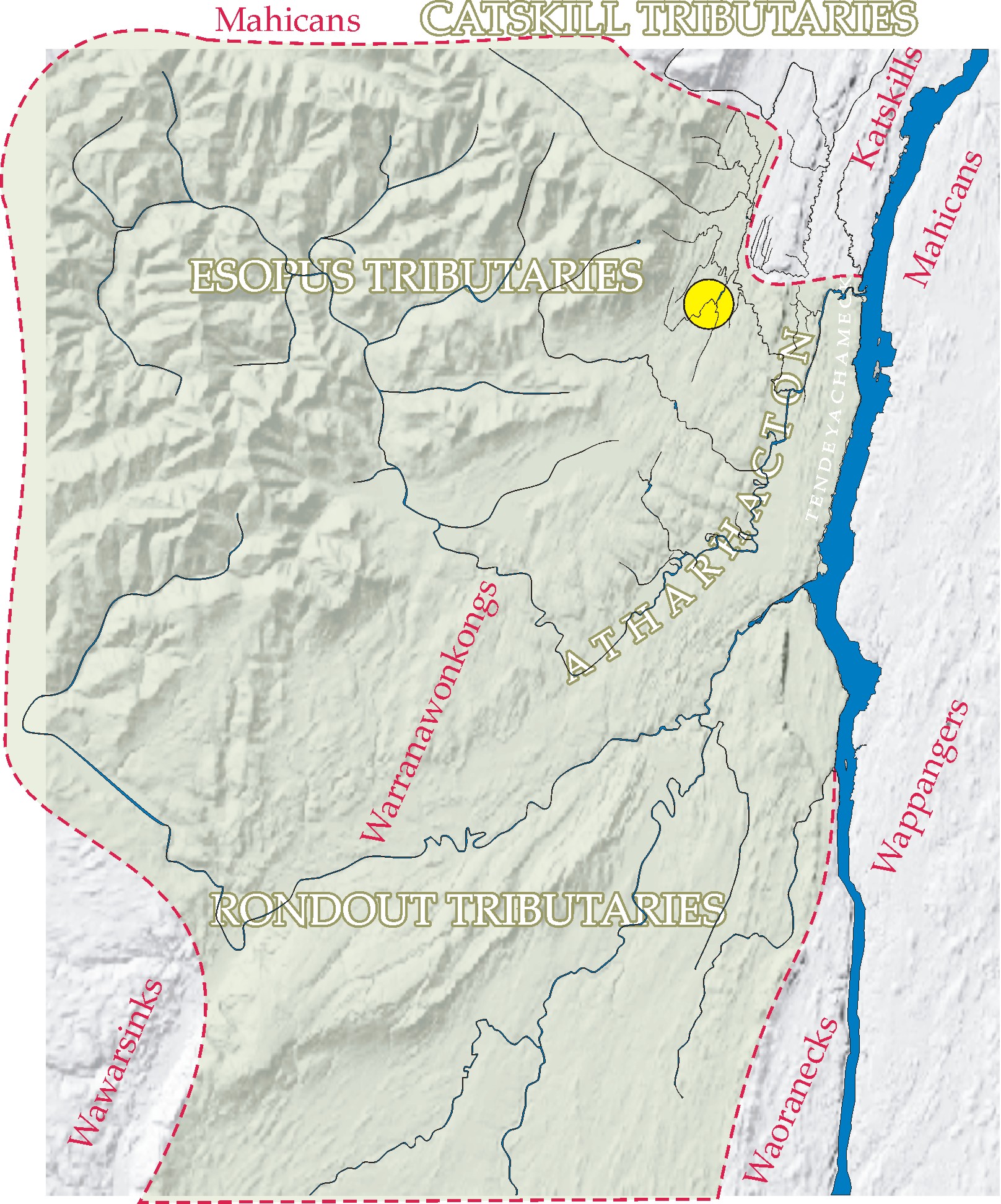 Hudson Valley 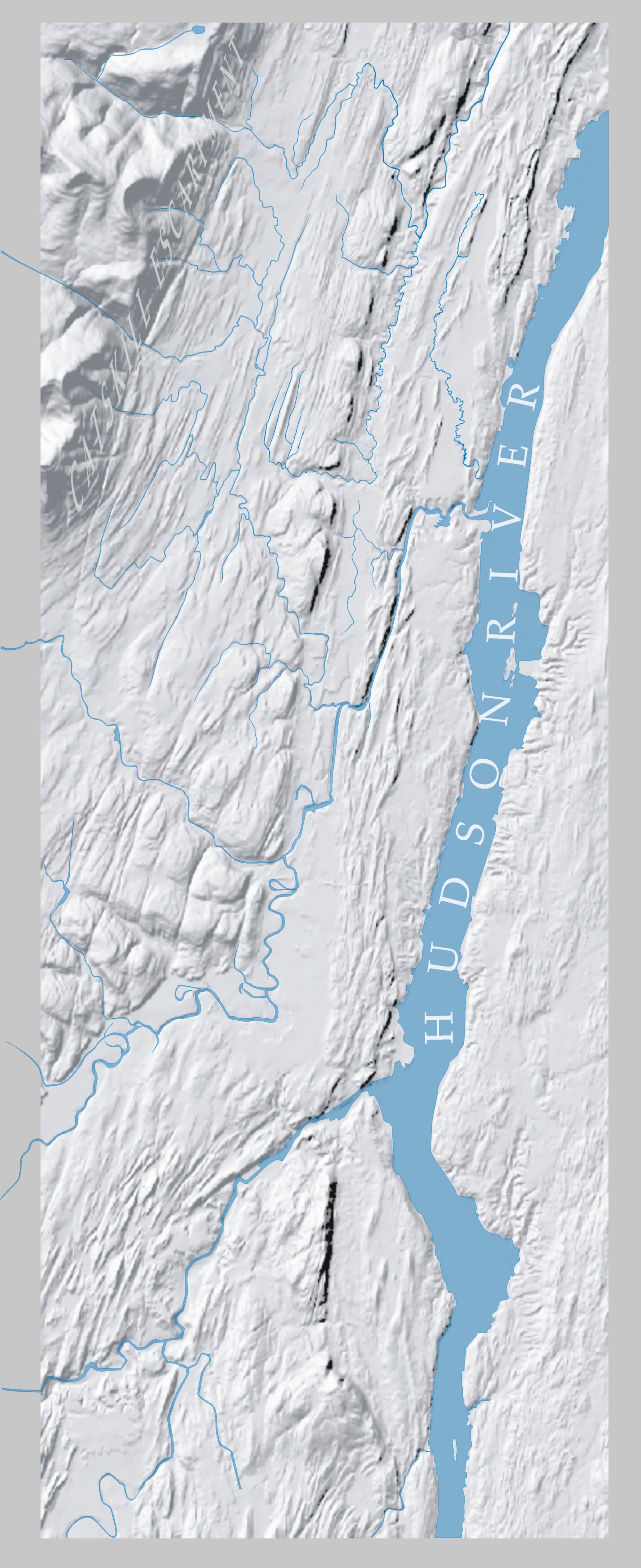 Above (top): Tribal boundaries at time of Discovery (link to plate with Dutch and English treaty takings and study of decline of native population) |
 Topology is a way to grasp the meaning of form. The Great Knot is a stone wall 2 meters wide that forms a knot. It stretches over a half acre of land and is made from the material of the land. It bridges a slash in the earth made by quarrying into its bedrock; into a natural ridge exposed at a waterfall. It recycles the rubble left after a product from this pit was removed and reorganizes it into this knot form to be a creation of the Anthropocene.
|
In the image below the red outline around this relief map is the upper extent of the lands of the Warranawonkong. This line encloses the blue creeks that drain the Catskill escarpment and the eastern slope of the Catskill piedmonts into the Hudson river. On this map the interior lines mark treaty and purchase lands and the boxes of text inside them tell of how and when these purchases happened. The odd Indian names placed on areas of this map were actually used extensively by the early colonists. The name Esopus was used for this part of the Hudson Valley until well after the Revolution. Atharacton meant Great Field and was the main plantation of the native peoples far before the arrival of Europeans. Below the PDF is a composition that covers the history of the demise of these people that Henry Hudson called "Loving People" Decline and Disappearance of the Warranawonkong
|
 Two major Indian wars were fought in the Esopus between 1659 and 1664 as the European settlers and their fields spread. It was not the sharing of land that caused the problems. The horses, cows and hogs of the settlers in the open Indian fields, the settlers' fencing good land and not planting it and the building of the village stockade directly atop the pathway of the ancient Indian trade route did stress the Indian's sense of fairness and reverence for their land and traditions. Rather, relative to the ancient trade route, the primary cause of the wars was the friendship of the Dutch with the Maquas (Mohawks) and their accepting visits from them and inviting them to travel on this pathway over the lands of the Lenni Lenape's Minsi peoples.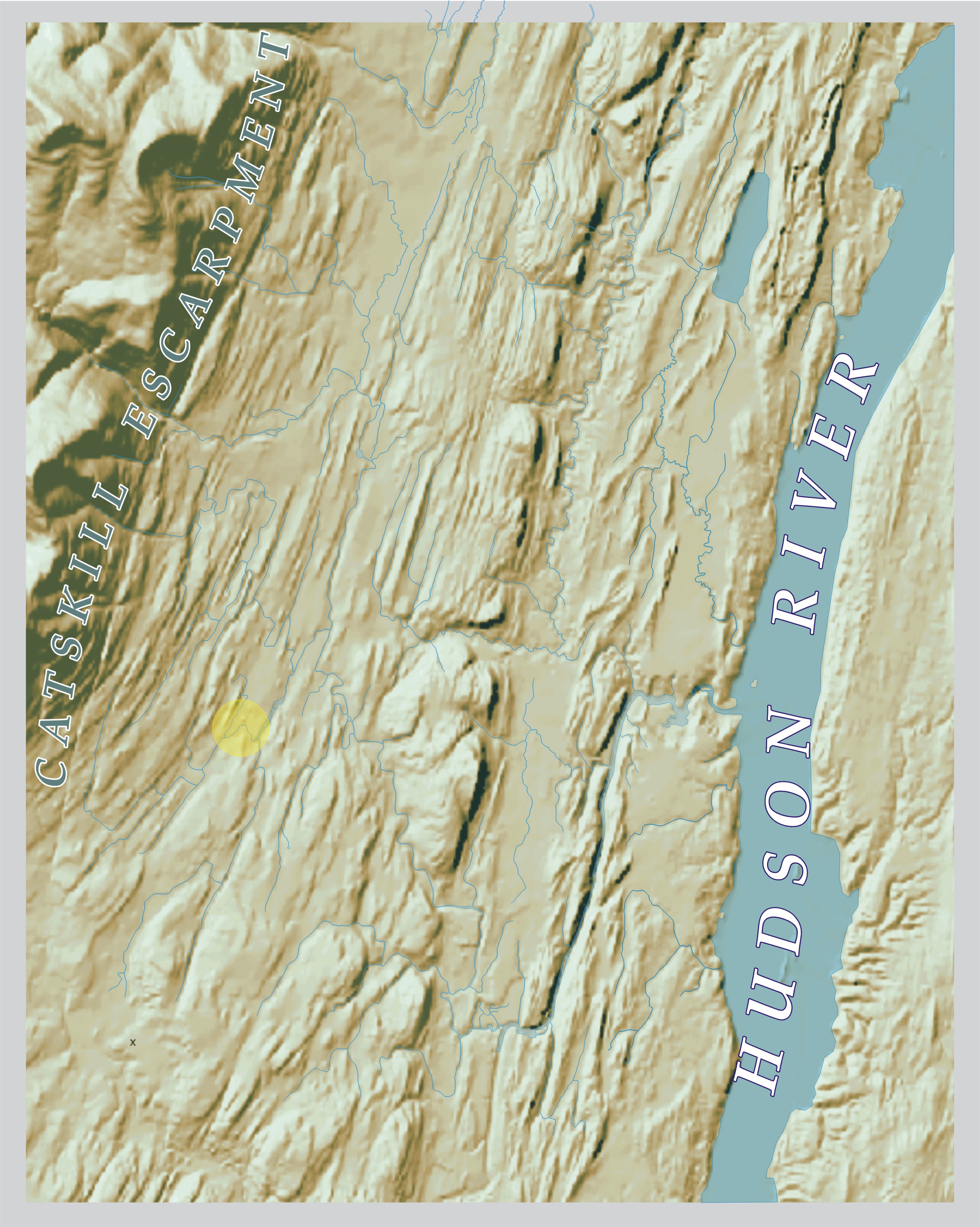
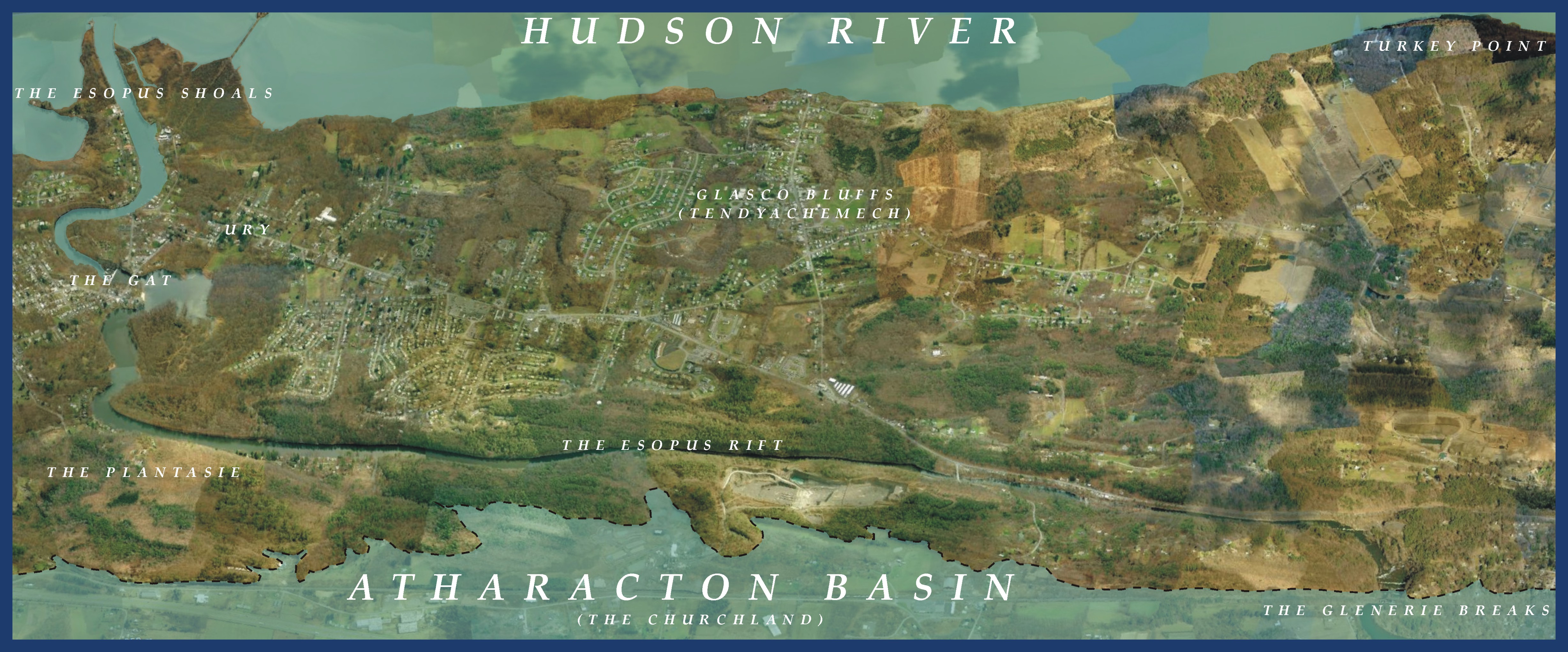
James Eights, M.D., a naturalist scholar in 1835, in the earliest beginnings of the natural sciences, published a study of the landforms between the Catskill escarpment and the Hudson River, following a transit passing through Mount Marion and the Glenerie Falls. This has the first observations on the presence of Lake Albany, the cause of the fissure at Glenerie and the formation of the great Esopus Shoals at Saugerties. The land form of the southern half of Saugerties frontage on the Hudson River, between the lighthouse and Turkey Point, was created by two geological formations and one ancient natural event. The west shore of the Hudson is formed of three ridges of dense rock filled with millions of years of deposits of sediments between them. In Saugerties one of these bowls runs the entire length from Flatbush on the southern border north to the Great Vly. Its level fields south of the village were the place of plantations called Tendyachemech where the native inhabitants were first encountered by Henry Hudson. A second bowl is formed west of this between the ridge above the Esopus Rift and the bluestone foothills of the Catskill Mountains. This level formation stretches across the complete southeast base of the Catskills, encompassing all the Churchland in Saugerties and all the Great Plain of Kingston and Hurley. It was the great plantation place the 17th century native inhabitants called Atharacton. This second bowl became the basin of an immense lake at the end of the last ice age, filled with melt-off as the glacier receded. At some early period beyond human memory a break occurred, at Glenerie, in the ridge that formed the eastern wall of this lake. The complete lake drained into the Esopus Rift forming the Glenerie Breaks. The force of this flood gouged out the gorge of the Esopus, ate away at the bend under the Plantesie and swirled past Stony Point to create the formations seen at the bridge and dam of the Village, the rock that inspired Henry Hudson's comments that there was good stone for houses in the Hudson Valley. |
All the rock material chipped from the banks of the Esopus Rift tumbled and flowed out into the Hudson River and settled to form the Esopus Shoals. The lighthouse and long dock at the Hudson's shipping channel mark the edge of the shoals, the largest incursion into the flow of the Hudson River anywhere along its length. This ancient event also caused an extensive landform change at the "Gat", a Dutch word meaning valley. The flood eddy at the Esopus Bend ate out a crater with steep walls forming the separation between the same elevations of Barclay Heights to the south and the level village business district on the north. In 1825 it was into the depression of this valley scoured out by this ancient flood that Henry Barclay dammed a pond to supply water power for the early industrialization of Saugerties. Along the slopes of this valley rose the streets of the village and the homes of the mill workers. Where the Esopus Rift meets tide water the vast debris field from that violent event blocked passage to the channel of the Hudson River for all of the colonial period. These fertile shoals were for centuries a place where the natives gathered shell fish and colonial herdsmen grazed and watered their cattle. These marshes were the eastern extent of a vast open meadowland that continued upstream into the rift and across the heights as one vast lea, or open pasture. It was the beauty of the open views this setting offered that inspired the first awareness of the potential of the Gat for industrial development, the accompanying clearing of a channel and the growth of Saugerties as a transportation center. The modern era began early in Saugerties. It had one of the earliest introductions of industrialization in America. But even as late as 1950 it still maintained this pastoral landscape setting with the estates of Ury, the home of the developers of the industries and businesses of the village, lining the edge of Barclay Heights with its long views over the river and to the mountains. It is this chain of events that first attracted artists to the beauty of the larger site, and form the Hudson River School of Painting. |
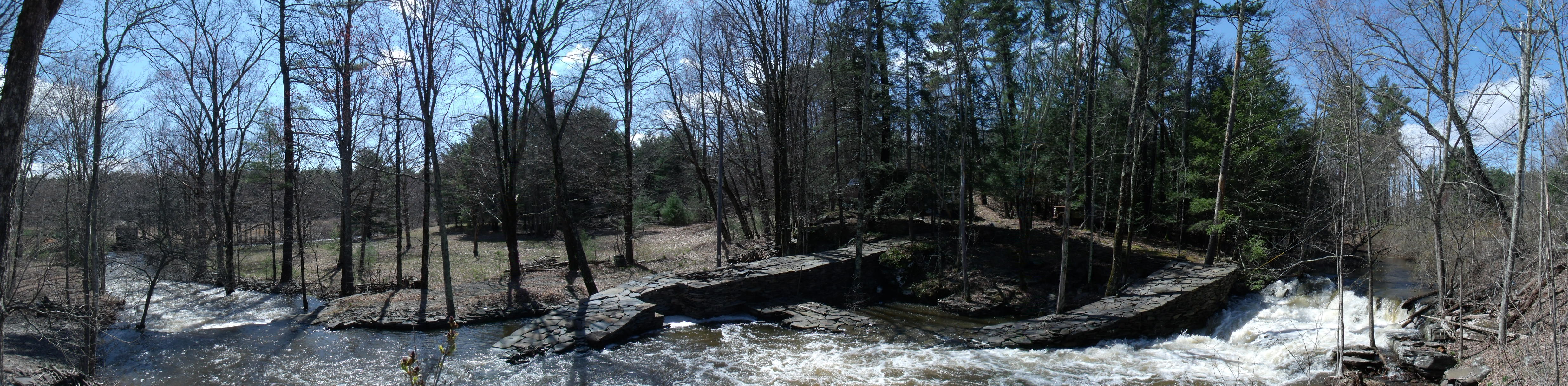 The Great Knot, April 27, 2011 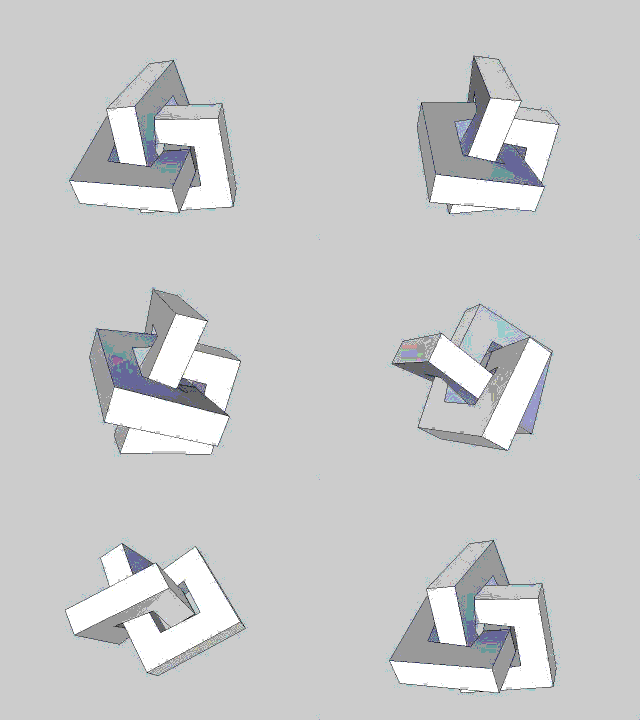 Michael Sullivan Smith, 2015 Click on animation to open parent web site greatknot.com in new browser window |